Using Latitude and Longitude - Lesson 2
Why are latitude and longitude measured in degrees?
In the field of mathematics, circles are measured in degrees. There are 360 degrees in a circle. Since the earth is basically circular, it was decided to measure latitude and longitude in degrees also.
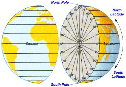
The first latitude line was the Equator (equally distant between the north and south poles). It is the largest of all latitude lines. All other latitude lines are measured in degrees north or south of the Equator. There are a maximum of 90 degrees of latitude to the north or the south of the Equator.
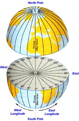
The first longitude line was the Prime Meridian. Any meridian could have been chosen as the Prime Meridian because they are all exactly the same. The Prime Meridian was selected by international agreement at the International Meridian Conference called by President Chester Arthur in October of 1884. Representatives from 25 nations met in Washington, D.C. All other longitude lines are measured in degrees east or west of the Prime Meridian. There are a maximum of 180 degrees on longitude to the east or the west of the Prime Meridian.
It is approximately 70 miles between two latitude lines. For
more accuracy in location, degrees can be divided into
smaller parts. One degree can be divided into 60 minutes (')
and one minute can be divided into 60 seconds ("). We will
not use minutes or seconds of latitude and longitude in
these lessons.


Click on one of the Globes above
to test your knowledge of important Latitude and
Longitude information.
Home | Instructions | Previous Lesson | Next Lesson